Tokyo Maps: The Ultimate 2026 Guide to Tokyo Maps, Neighborhoods, Train Lines, Attractions & Navigation
Tokyo maps are much more than simple geographic diagrams; they are essential tools for understanding the city’s neighborhoods, transportation networks, attractions, walking routes, airports, shopping districts, and everyday urban life. The most useful Tokyo map is rarely a single map—it is a combination of area maps, railway maps, subway maps, attraction maps, walking maps, cycling maps, airport maps, and digital navigation tools used according to the journey Tokyo Nature
What Are Tokyo Maps?
The phrase “Tokyo maps” can refer to many different types of maps.
A traveler might be looking for:
- Tokyo city maps
- Tokyo tourist maps
- Tokyo subway maps
- Tokyo train maps
- Tokyo neighborhood maps
- Tokyo attraction maps
- Tokyo airport maps
- Tokyo walking maps
- Tokyo cycling maps
- Tokyo shopping maps
- Tokyo restaurant maps
- Tokyo railway maps
- Tokyo district maps
- Tokyo street maps
- Tokyo digital maps
- Tokyo offline maps
- Tokyo transportation maps
- Tokyo maps for tourists
- Tokyo maps for families
- Tokyo maps for seniors
- Tokyo maps for business travelers
Each serves a different purpose.
A railway map explains connectivity.
A street map explains geography.
A tourist map explains attractions.
A neighborhood map explains local character.
A walking map explains what can realistically be explored on foot.
A digital navigation map can combine several of these functions.
Understanding that distinction is the first step toward using Tokyo maps effectively.
Why Tokyo Maps Can Feel Complicated
Tokyo is not difficult because maps are poorly designed.
It is difficult because the city itself is extraordinarily layered.
A single area can contain:
- Multiple railway operators
- Several subway lines
- Different station entrances
- Underground shopping areas
- Elevated railway tracks
- Pedestrian bridges
- Large department stores
- Residential streets
- Office buildings
- Temples
- Shrines
- Parks
- Rivers
- Commercial roads
- Narrow side streets
A traditional two-dimensional map may show only part of this information.
That is why Tokyo travelers often need more than one map.
The Five Maps Every Tokyo Traveler Should Understand
For most visitors, five map categories are especially useful.
Geographic Tokyo Map
This shows the overall location of districts, rivers, bays, parks, and major areas.
Railway Map
This shows how train lines connect different parts of Tokyo.
Subway Map
This focuses specifically on underground transportation.
Neighborhood Map
This provides street-level context.
Digital Navigation Map
This combines location, directions, transportation information, businesses, walking routes, and real-time updates.
Each answers a different question.
Tokyo Geographic Map
A geographic map is the best starting point for understanding Tokyo’s physical layout.
Tokyo faces Tokyo Bay to the southeast.
The city extends inland toward western areas, while the wider metropolitan region stretches considerably farther beyond the administrative boundaries of Tokyo.
Major Geographic Areas
Visitors often divide Tokyo into broad areas such as:
- Central Tokyo
- Eastern Tokyo
- Western Tokyo
- Northern Tokyo
- Southern Tokyo
- Tokyo Bay
- Outer Tokyo
These categories are useful but should not be treated as rigid official divisions for every purpose.
Central Tokyo
Central Tokyo contains many of the city’s best-known commercial and business areas.
Important districts include:
- Ginza
- Marunouchi
- Nihombashi
- Otemachi
- Tokyo Station
- Akasaka
- Roppongi
- Toranomon
- Shimbashi
Western Tokyo
Western Tokyo includes major areas such as:
- Shinjuku
- Shibuya
- Nakano
- Kichijoji
- Setagaya
- Suginami
Eastern Tokyo
Eastern Tokyo includes areas such as:
- Asakusa
- Ueno
- Sumida
- Ryogoku
- Koto
- Edogawa
Northern Tokyo
Northern areas include neighborhoods such as:
- Akabane
- Itabashi
- Kita
- Adachi
Southern Tokyo
Southern areas include:
- Shinagawa
- Meguro
- Ota
- parts of Minato
Tokyo Bay
Tokyo Bay is particularly important for modern Tokyo.
Areas around the waterfront include:
- Odaiba
- Toyosu
- Ariake
- Harumi
- Shinagawa waterfront
- Tokyo Disney Resort area outside central Tokyo
A geographic map makes these relationships much easier to understand.
Tokyo Neighborhood Maps
Neighborhood maps are often more useful than citywide maps once you arrive.
A citywide map tells you that Shibuya exists.
A neighborhood map can show:
- Restaurants
- Cafés
- Shopping streets
- Side streets
- Parks
- Temples
- Shrines
- Station exits
- Local businesses
This is especially useful for travelers who want to experience Tokyo beyond major tourist attractions.
Tokyo Maps for First-Time Visitors
First-time visitors should avoid trying to understand every neighborhood at once.
Instead, start with a mental map of several major areas.
Tokyo Station and Marunouchi
Think:
Business + Imperial Palace + luxury shopping + major transportation
Ginza
Think:
Shopping + department stores + restaurants + central location
Shibuya
Think:
Youth culture + shopping + nightlife + major station
Shinjuku
Think:
Huge station + business + entertainment + shopping
Asakusa
Think:
Traditional Tokyo + temples + old streets + tourism
Ueno
Think:
Museums + park + markets + transportation
Harajuku
Think:
Fashion + youth culture + Meiji area
Akihabara
Think:
Electronics + anime and gaming culture + specialty shopping
Roppongi
Think:
Nightlife + museums + international atmosphere + high-rise development
Odaiba
Think:
Waterfront + modern attractions + entertainment
This mental framework makes a Tokyo map much easier to interpret.
Tokyo Subway Maps
Tokyo subway maps are among the most important maps for visitors.
At first glance, they can look like a collection of colorful spaghetti.
But there is an underlying logic.
Each line normally has:
- A distinct color
- A line name
- A letter or identification system
- Station numbers
- Transfer stations
Tokyo Metro
Tokyo Metro operates a large network of subway lines serving central Tokyo.
Its lines include:
- Ginza Line
- Marunouchi Line
- Hibiya Line
- Tozai Line
- Chiyoda Line
- Yurakucho Line
- Hanzomon Line
- Namboku Line
- Fukutoshin Line
Toei Subway
Toei Subway operates:
- Asakusa Line
- Mita Line
- Shinjuku Line
- Oedo Line
Together, these systems provide extensive coverage of central Tokyo.
How to Read a Tokyo Subway Map
Do not read the entire map.
Start with your destination.
Step One: Find Your Destination Station
Locate the station name.
Step Two: Identify the Line
Look at the line color and identification.
Step Three: Find Your Starting Station
Then determine whether you need a transfer.
Step Four: Count Transfers
One route may require two transfers while another requires one.
Step Five: Check the Station Exit
Once you arrive, determine which exit is closest to your destination.
This final step is often overlooked.
Why Station Exits Matter on Tokyo Maps
Large Tokyo stations can have numerous exits.
A map may show:
Shinjuku Station
But that does not mean every exit is equally useful.
One exit may place you beside a department store.
Another may lead toward office towers.
Another may lead toward a bus terminal.
Another may be much closer to your restaurant.
For this reason, a detailed station-area map can sometimes be more valuable than a broad Tokyo map.
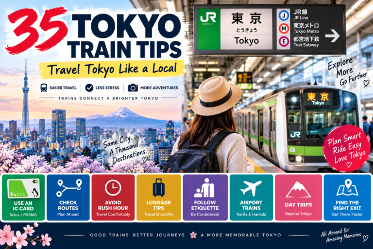
Tokyo Railway Maps
Tokyo’s railway system extends far beyond the subway.
Railway maps include:
- JR lines
- Private railway lines
- Airport railways
- Monorails
- Regional services
- Intercity services
JR Yamanote Line
The Yamanote Line is particularly useful for understanding Tokyo geographically.
It connects many major districts in a loop-like route.
Major areas associated with the line include:
- Tokyo
- Ueno
- Ikebukuro
- Shinjuku
- Shibuya
- Shinagawa
This makes it useful as a mental framework for first-time travelers.
Private Railway Maps
Private railway companies are essential to Tokyo’s mobility network.
Important operators include:
- Tokyu
- Keio
- Odakyu
- Seibu
- Tobu
- Keisei
- Keikyu
These railway maps become particularly useful when traveling outside the central tourist core.
Tokyo Maps for Airport Travel
Airport maps are different from ordinary Tokyo maps because travelers are usually dealing with luggage, terminals, and time constraints.
Tokyo has two primary international airports:
- Haneda Airport
- Narita International Airport
Haneda Airport Map
Haneda is relatively close to central Tokyo.
Its terminals are connected to transportation systems including:
- Keikyu Railway
- Tokyo Monorail
- Airport buses
- Taxis
When using a Haneda map, pay attention to:
- Terminal number
- Railway station
- Bus stops
- Arrival area
- Departure area
- Hotel shuttle information
Narita Airport Map
Narita is much farther from central Tokyo.
Important transportation connections include:
- Narita Express
- Keisei Skyliner
- Airport buses
- Taxis
A Narita map should be read together with a central Tokyo transportation map.
Tokyo Tourist Maps
Tourist maps prioritize attractions rather than transportation.
A useful Tokyo tourist map might show:
- Temples
- Shrines
- Museums
- Parks
- Shopping districts
- Observation decks
- Famous streets
- Entertainment districts
- Markets
- Waterfront attractions
Why Tourist Maps Can Be Misleading
Tourist maps often compress geographic distances to fit information on a single page.
An attraction may look close to another attraction but still require significant walking or transportation.
Always check actual travel distance before planning a packed itinerary.
Tokyo Maps for Popular Tourist Areas
Asakusa Map
A good Asakusa map should include:
- Senso-ji
- Kaminarimon
- Nakamise
- Sumida River
- Asakusa Station
- Nearby shopping streets
The area is compact enough that walking is an important part of exploration.
Shibuya Map
A Shibuya map should help you understand:
- Shibuya Station
- Shibuya Scramble
- Center-gai
- Dogenzaka
- Miyashita Park
- Shopping areas
- Nearby Harajuku direction
Shinjuku Map
Shinjuku is one of the areas where detailed maps are especially valuable.
You may need to distinguish:
- East Exit
- West Exit
- South Exit
- Kabukicho
- Tokyo Metropolitan Government area
- Shinjuku Gyoen
- Department stores
- Bus terminals
Ueno Map
A Ueno map can connect:
- Ueno Station
- Ueno Park
- Museums
- Zoo
- Ameyoko
- Okachimachi
Ginza Map
A Ginza map should emphasize:
- Shopping streets
- Department stores
- Luxury retail
- Restaurants
- Subway stations
- Nearby Yurakucho
- Tokyo Station direction
Tokyo Maps for Shopping
Shopping maps are particularly useful because Tokyo’s commercial districts can be large.
Shibuya Shopping Map
Useful for:
- Fashion
- Youth brands
- Department stores
- Electronics
- Restaurants
Ginza Shopping Map
Useful for:
- Luxury brands
- Department stores
- Premium dining
- Specialty shops
Akihabara Shopping Map
Useful for:
- Electronics
- Computer equipment
- Specialty stores
- Collectibles
- Entertainment
Harajuku Shopping Map
Useful for:
- Street fashion
- Independent stores
- Youth-oriented retail
- Cafés
Tokyo Maps for Food Travelers
Food maps require a different strategy.
A restaurant may technically be “near” a station while still being difficult to find.
Narrow streets and building entrances can make restaurant navigation challenging.
What a Food Map Should Show
Ideally:
- Station
- Exit
- Street
- Building
- Floor
- Restaurant name
- Nearby landmark
This is particularly useful for restaurants inside multi-floor buildings.
Tokyo Walking Maps
Walking maps are excellent for travelers who want to slow down.
They can highlight:
- Pedestrian streets
- Parks
- Historic neighborhoods
- Shopping streets
- River walks
- Architectural areas
- Scenic viewpoints
Why Walking Maps Matter
Tokyo’s most interesting details are often not located at famous landmarks.
They are between them.
A walking map helps turn transportation space into exploration space.
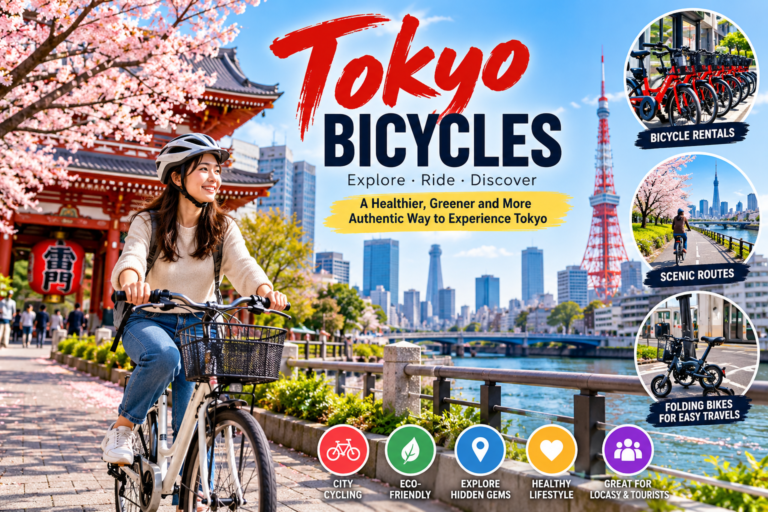
Tokyo Cycling Maps
Cycling maps focus on:
- Bike-friendly roads
- Riverside routes
- Parks
- Waterfronts
- Bicycle parking
- Rental stations
- Bridges
- Long-distance routes
Cycling maps are especially useful around:
- Sumida River
- Edogawa
- Tokyo Bay
- Outer Tokyo neighborhoods
Tokyo Maps for Families
Families need maps that show more than attractions.
Useful family map information includes:
- Restrooms
- Baby facilities
- Elevators
- Parks
- Family restaurants
- Short walking routes
- Accessible entrances
- Taxi stands
- Major stations
Why Family Maps Should Be Different
A 15-minute walk may be easy for an adult.
With a stroller and tired child, it can feel much longer.
Family mapping is therefore about practical distance, not just geographic distance.
Tokyo Maps for Seniors
Senior travelers can benefit from maps highlighting:
- Elevators
- Escalators
- Benches
- Accessible entrances
- Short routes
- Nearby taxis
- Rest areas
The shortest route on a map may not be the easiest physical route.
Tokyo Maps for Travelers With Disabilities
Accessibility-focused maps should ideally provide information about:
- Step-free entrances
- Elevators
- Accessible toilets
- Platform access
- Wheelchair-friendly routes
- Station assistance
- Accessible transportation
Travelers with specific mobility needs should verify conditions for individual stations and destinations because accessibility can vary.
Tokyo Maps for Business Travelers
Business travelers often need maps that focus on:
- Business districts
- Convention centers
- Hotels
- Train stations
- Airports
- Meeting venues
- Restaurants
- Taxi access
Major Business Areas
Useful districts include:
- Marunouchi
- Otemachi
- Nihombashi
- Shinagawa
- Shinjuku
- Shibuya
- Roppongi
- Toranomon
- Akasaka
Tokyo Maps for Students
Students may need maps showing:
- Universities
- Dormitories
- Railway stations
- Libraries
- Shopping areas
- Affordable restaurants
- Parks
- Bicycle routes
A neighborhood map becomes particularly important for long-term residents.
Tokyo Maps for Photographers
Photographers can use maps differently.
Instead of asking:
“What attractions are nearby?”
they may ask:
“Where will I get the best relationship between buildings, streets, rivers, light, and people?”
Useful Photography Map Layers
- Sunrise direction
- Sunset direction
- Waterfront
- Elevated viewpoints
- Bridges
- Traditional streets
- Modern architecture
- Parks
- Station areas
Maps become planning tools for visual storytelling.
Tokyo Maps for First-Time Visitors
First-time visitors should create a simple personal map.
Mark:
- Hotel
- Nearest station
- Airport
- Major attractions
- Restaurants
- Emergency location
- Shopping area
Then organize attractions into geographic clusters.
This can prevent unnecessary cross-city travel.
Tokyo Maps for Repeat Visitors
Repeat visitors should consider maps beyond the famous districts.
Explore:
- Koenji
- Kichijoji
- Yanaka
- Kagurazaka
- Shimokitazawa
- Daikanyama
- Jiyugaoka
- Nakameguro
- Kiyosumi-Shirakawa
- Jimbocho
These neighborhoods can provide a different understanding of Tokyo.
Digital Tokyo Maps
Digital maps have transformed how people navigate Tokyo.
Modern navigation platforms can provide:
- Walking directions
- Train directions
- Bus information
- Estimated travel time
- Business locations
- Reviews
- Opening hours
- Real-time updates
- Street-level imagery
- Location sharing
Advantages of Digital Maps
Digital maps are dynamic.
Printed maps become outdated.
Digital platforms can update:
- Station information
- Business locations
- Road changes
- Transportation disruptions
- Opening hours
Limitations of Digital Maps
Digital navigation is not perfect.
Problems can include:
- Weak signal
- Battery depletion
- Incorrect business information
- Confusing station entrances
- Indoor positioning errors
- Language issues
- Over-reliance on the suggested route
The best strategy is to use digital maps while maintaining a basic geographic understanding of Tokyo.
Offline Tokyo Maps
Offline maps are useful when:
- You have limited mobile data
- Your phone battery is low
- You are traveling internationally
- You are underground
- You enter an area with weak connectivity
Before traveling, save important locations.
At minimum, save:
- Hotel
- Airport
- Train station
- Major attractions
- Emergency contact information
Tokyo Maps and Station Navigation
One of the hardest parts of Tokyo navigation is not finding the station.
It is finding your way through the station.
Large stations can function almost like underground cities.
Station Maps Can Show
- Platforms
- Exits
- Toilets
- Shops
- Elevators
- Ticket gates
- Connecting lines
- Underground malls
- Bus terminals
Always look for station maps when transferring.
Tokyo Station Maps
Tokyo Station deserves special attention.
It contains multiple railway services and extensive underground areas.
A Tokyo Station map can help distinguish:
- Marunouchi side
- Yaesu side
- JR platforms
- Shinkansen platforms
- Subway connections
- Underground shopping
- Nearby business districts
For first-time visitors, leaving through the correct side of the station can save considerable time.
Shinjuku Station Maps
Shinjuku is another location where a detailed station map can be extremely valuable.
The station environment includes multiple railway operators and numerous surrounding commercial and business facilities.
A traveler who simply searches “Shinjuku Station” may still have several minutes of navigation ahead.
Shibuya Station Maps
Shibuya has undergone major redevelopment over time, making current map information especially important.
Visitors should pay attention to:
- Station exits
- Pedestrian routes
- Connected commercial buildings
- Underground passages
- Elevated pedestrian walkways
Tokyo Maps and Neighborhood Boundaries
Tokyo neighborhoods can be confusing because names used by tourists, businesses, train stations, and administrative systems do not always match perfectly.
For example, a destination may market itself using a famous district name while its formal address belongs to a smaller neighborhood.
This is why exact street information matters.
How to Read a Tokyo Address
Japanese addresses are structured differently from many Western addresses.
An address may contain:
- Prefecture/metropolitan area
- City or special ward
- District
- Chome
- Block
- Building
Understanding this structure can help when entering an address into a map.
Tokyo Maps and Postal Addresses
A restaurant might have an address that looks complicated.
Do not assume the first part of the address is the neighborhood you recognize.
Use the full address whenever possible.
This is especially important for:
- Hotels
- Apartments
- Small restaurants
- Clinics
- Offices
- Meeting locations
Tokyo Maps for Hotels
Hotel maps should be evaluated based on transportation rather than appearance alone.
Before booking, check:
- Nearest station
- Station exit
- Walking time
- Number of transfers to major attractions
- Airport route
- Nearby restaurants
- Late-night transportation
A hotel advertised as “near Shibuya” may still require a meaningful walk to the actual station.
Tokyo Maps and Hotel Location Strategy
Best for First-Time Visitors
Choose an area with several transportation options.
Best for Families
Choose an area with straightforward station access and elevators.
Best for Business
Choose a location near the meeting district.
Best for Nightlife
Choose a neighborhood with convenient evening transportation.
Best for Budget Travelers
Consider neighborhoods slightly outside the most expensive central districts but close to efficient railway lines.
Tokyo Maps and Day-Trip Planning
A map is essential when planning day trips outside central Tokyo.
Potential destinations include:
- Mount Takao
- Kamakura
- Yokohama
- Kawagoe
- Nikko
- Hakone
- Tokyo Disney Resort
These destinations require different transportation strategies.
Why Day-Trip Maps Matter
A Tokyo city map cannot show enough detail for destinations outside the metropolitan core.
Use a regional map once you leave central Tokyo.
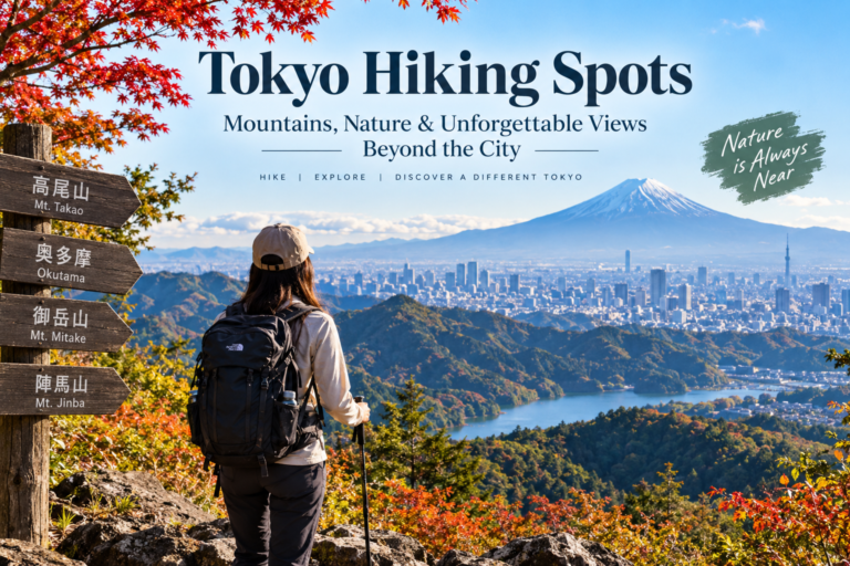
Tokyo Maps and Mount Takao
Mount Takao is west of central Tokyo and can be reached using railway services.
A good map should show:
- Tokyo starting point
- Railway line
- Takaosanguchi
- Mountain base
- Cable car
- Chairlift
- Hiking routes
Tokyo Maps and Yokohama
Yokohama is close enough to Tokyo to make a popular day trip.
The map relationship between Tokyo and Yokohama helps explain why several railway operators serve the corridor.
Tokyo Maps and Kamakura
Kamakura requires a regional perspective.
Once there, a local walking map becomes more useful than a Tokyo city map.
Tokyo Maps and Nikko
Nikko is considerably farther from Tokyo.
A regional railway map becomes essential.
Tokyo Maps and Hakone
Hakone requires understanding multiple transportation modes.
Depending on the itinerary, travelers may use:
- Railway
- Bus
- Cable car
- Ropeway
- Boat
This is an excellent example of why one map is rarely enough.
Tokyo Maps and Tokyo Disney Resort
Tokyo Disney Resort is located outside central Tokyo.
Travelers should use a regional transportation map to understand the relationship between:
- Tokyo Station
- Maihama
- Resort transportation
- Hotels
- Parks
Tokyo Maps and Public Transportation
Transportation maps are often schematic rather than geographically accurate.
This is intentional.
A subway map is designed to show connections clearly.
It is not necessarily designed to show actual distances.
Why Schematic Maps Are Useful
If a map accurately represented every street curve, station location, and geographic distance, it could become harder to understand the network.
The simplified design makes transportation relationships clearer.
The Difference Between a Geographic Map and a Subway Map
Imagine two stations are 1 km apart geographically.
On a subway map, they might appear much farther apart because of the way the line is drawn.
This does not mean the map is wrong.
It means it has a different purpose.
Geographic Map
Best for:
- Distance
- Direction
- Neighborhoods
- Rivers
- Streets
Subway Map
Best for:
- Lines
- Transfers
- Station sequence
- Network planning
Use both.
Tokyo Maps and Walking Distance
One of the most useful habits is checking walking distance separately from transportation distance.
A navigation app might tell you:
Train: 18 minutes
But the full trip may be:
- 7 minutes walking to station
- 5 minutes inside station
- 18 minutes train
- 8 minutes transfer
- 10 minutes walking
The real journey is more than the train ride.
Tokyo Maps and Travel Time
Maps increasingly show estimated travel time.
But these estimates can change because of:
- Crowd levels
- Transfer distance
- Traffic
- Train frequency
- Weather
- Walking speed
Always treat estimates as planning guidance rather than guarantees.
Tokyo Maps for Rainy Days
Weather-specific maps can help you choose routes with:
- Underground passages
- Covered shopping streets
- Subway connections
- Shorter outdoor walking distances
This can dramatically improve a rainy-day itinerary.
Tokyo Maps for Hot Weather
In summer, consider routes that minimize outdoor exposure.
Maps can help identify:
- Underground passages
- Shopping malls
- Station-connected buildings
- Parks with shade
- Indoor attractions
Tokyo Maps for Winter
Winter maps can help plan around:
- Indoor shopping
- Museums
- Cafés
- Covered walkways
- Short outdoor transfers
Tokyo Maps for Cherry Blossom Season
Seasonal maps can highlight:
- Ueno Park
- Meguro River
- Chidorigafuchi
- Sumida Park
- Shinjuku Gyoen
- Other seasonal viewing areas
However, crowds can make actual walking conditions very different from what a static map suggests.
Tokyo Maps for Autumn
Autumn maps can help identify:
- Parks
- Gardens
- Tree-lined streets
- Temple areas
- Scenic walking routes
Tokyo Maps for Night Photography
Night maps can help identify:
- Neon districts
- Elevated viewpoints
- Bridges
- Waterfront areas
- Major intersections
- Entertainment districts
Always consider safety and local restrictions when planning nighttime photography.
Ten Major Map and Navigation Brands or Platforms for Tokyo
The following brands and platforms represent different approaches to mapping and navigation. They are not ranked because each serves a different purpose.
| Brand / Platform | Main Function | Tokyo Use Case | Key Strength | Best For |
|---|---|---|---|---|
| Google Maps | Digital navigation | Streets, businesses, transit | Broad information | Most travelers |
| Apple Maps | Digital navigation | Walking and transportation | Device integration | iPhone users |
| Yahoo! JAPAN Maps | Local mapping | Japanese local navigation | Local information | Residents and advanced users |
| NAVITIME | Transportation navigation | Train and route planning | Detailed transit tools | Commuters |
| Jorudan | Transit route planning | Railway journeys | Route comparison | Train travelers |
| Ekitan | Transit planning | Train schedules and fares | Rail-focused tools | Commuters |
| Tokyo Metro Map | Subway network | Metro navigation | Subway clarity | Subway users |
| JR East Maps/Information | Railway navigation | JR routes | Rail network information | JR travelers |
| OpenStreetMap | Open mapping | Streets and geographic detail | Community mapping | Researchers and advanced users |
| Tokyo tourism maps | Travel planning | Attractions and districts | Visitor-focused information | Tourists |
Google Maps for Tokyo
Google Maps is particularly useful because it combines:
- Walking
- Train
- Subway
- Bus
- Cycling
- Businesses
- Restaurants
- Hotels
- Attractions
Its greatest strength is the combination of geographic and transportation information.
Apple Maps for Tokyo
Apple Maps can be useful for travelers already within Apple’s ecosystem.
Its integration with smartphones, location services, and walking navigation makes it convenient for many users.
Yahoo! JAPAN Maps
Yahoo! JAPAN’s mapping services can be particularly useful for users comfortable with Japanese-language digital platforms and local information.
NAVITIME
NAVITIME is strongly associated with transportation planning in Japan.
It can be particularly useful for users who want detailed route information.
Jorudan
Jorudan is another established Japanese transportation route-planning service.
It is useful for comparing railway routes and understanding transfer options.
Ekitan
Ekitan focuses heavily on Japanese train route information.
It can be useful for travelers who want detailed railway planning.
Tokyo Metro Mapping
Official subway maps are particularly valuable because they show the network in the operator’s own format.
These maps should be used alongside geographic maps.
JR East Mapping and Route Information
JR East resources are particularly useful when your journey involves JR services, especially longer routes.
OpenStreetMap
OpenStreetMap provides community-maintained geographic information.
It can be useful for:
- Researchers
- Developers
- Advanced travelers
- Geographic projects
- Specialized mapping
Tokyo Tourism Maps
Tourism maps prioritize:
- Attractions
- Districts
- Visitor services
- Transportation
- Sightseeing routes
They are often ideal for first-time visitors.
Tokyo Map Comparison Table by User Type
| User | Best Map Type | Why |
|---|---|---|
| First-time tourist | Tourist + digital map | Simple attraction planning |
| Commuter | Railway + transit map | Efficient route planning |
| Family | Digital + accessibility map | Practical route selection |
| Senior traveler | Accessibility + station map | Reduced walking |
| Cyclist | Cycling + geographic map | Route safety and distance |
| Photographer | Geographic + walking map | Scenic discovery |
| Business traveler | Railway + business-area map | Reliable meeting access |
| Student | Neighborhood + transit map | Everyday navigation |
| Food traveler | Neighborhood + digital map | Restaurant discovery |
| Day-trip traveler | Regional + railway map | Intercity planning |
How to Plan a Tokyo Trip Using Maps
The best map strategy starts before your flight.
Step One: Mark Your Hotel
Your hotel becomes the center of your personal transportation map.
Step Two: Mark the Nearest Station
Identify the exact station and line.
Step Three: Mark the Airport
Understand your arrival and departure routes.
Step Four: Mark Major Attractions
Do not immediately create a complicated itinerary.
Simply place the attractions on the map.
Step Five: Group Nearby Attractions
This is where geographic planning becomes powerful.
Step Six: Build Daily Clusters
Create one geographic cluster for each day.
Step Seven: Add Restaurants
Choose restaurants near your planned area rather than crossing Tokyo unnecessarily.
Step Eight: Add Backup Options
If the weather changes, have indoor alternatives.
Example of a Map-Based Tokyo Itinerary
Day One: Traditional Tokyo
Group:
- Asakusa
- Senso-ji
- Sumida area
- Ueno
Day Two: Modern Tokyo
Group:
- Shibuya
- Harajuku
- Omotesando
Day Three: Central Tokyo
Group:
- Tokyo Station
- Marunouchi
- Imperial Palace area
- Ginza
Day Four: Western Tokyo
Group:
- Shinjuku
- Shinjuku Gyoen
- Nearby neighborhoods
Day Five: Tokyo Bay
Group:
- Odaiba
- Toyosu
- Waterfront
This approach minimizes unnecessary cross-city travel.
Common Tokyo Map Mistakes
Mistake 1: Using Only One Map
No single map is perfect for everything.
Solution
Combine geographic, transportation, and neighborhood maps.
Mistake 2: Trusting Geographic Appearance
Two destinations can look close but have inconvenient transportation connections.
Solution
Check actual travel time.
Mistake 3: Ignoring Station Exits
The correct station with the wrong exit can create unnecessary walking.
Solution
Check exit numbers.
Mistake 4: Confusing Train and Subway Maps
They represent different parts of the network.
Solution
Understand which operator you are using.
Mistake 5: Planning Too Much
A map makes Tokyo look compact when viewed on a screen.
Solution
Plan fewer major destinations per day.
Mistake 6: Forgetting Walking
Transportation maps do not always show the effort required inside stations.
Solution
Use door-to-door navigation.
Mistake 7: Depending Entirely on Live Navigation
Technology can fail.
Solution
Keep offline information and basic geographic knowledge.
Mistake 8: Ignoring Weather
A beautiful walking route may be unpleasant in heavy rain.
Solution
Have an indoor or transit alternative.
Mistake 9: Using an Outdated Map
Construction and redevelopment can change station environments.
Solution
Use current maps when possible.
Mistake 10: Assuming Every Map Uses the Same Scale
A subway diagram is not a geographic map.
Solution
Understand the purpose of the map before measuring distance.
Pros of Using Tokyo Maps
Better Planning
Maps allow you to visualize your itinerary before leaving.
Less Backtracking
Geographic clustering reduces unnecessary travel.
Better Transportation Decisions
You can compare train, subway, bus, walking, and cycling options.
Easier Neighborhood Discovery
Maps reveal areas outside major tourist routes.
Greater Independence
You become less dependent on tour groups.
Better Time Management
Knowing distances helps create realistic schedules.
Cons and Limitations of Tokyo Maps
Information Overload
Too much information can make navigation harder.
Different Map Styles
Railway maps and geographic maps can appear contradictory.
Rapid Urban Change
Station areas can change through redevelopment.
Digital Dependence
Phone-based navigation depends on battery and connectivity.
Accessibility Gaps
Not every map provides detailed accessibility information.
Human Error
Even the best map cannot prevent a traveler from choosing the wrong station exit.
The Most Important Tokyo Map Is Often the Smallest One
This may sound surprising.
The map of Tokyo as a whole is useful for understanding geography.
But when you are standing outside Shinjuku Station, the most valuable map may be the tiny map showing:
- Your current location
- Four nearby exits
- One street
- Two buildings
- Your destination
Navigation becomes easier as the map becomes more relevant to the immediate decision.
Tokyo Maps and Cognitive Load
Tokyo is a useful example of a broader navigation principle:
More information does not always mean better navigation.
A map containing every street, railway, restaurant, building, attraction, and business can overwhelm a first-time visitor.
The best map is the one that answers the question you currently have.
If your question is:
“How do I get to Shibuya?”
Use a transportation map.
If your question is:
“Where is this café?”
Use a neighborhood map.
If your question is:
“What can I see nearby?”
Use an attraction map.
If your question is:
“How far is Asakusa from Shinjuku?”
Use a geographic map.
Tokyo Maps and Artificial Intelligence
AI is beginning to change how people interact with maps.
Instead of manually studying multiple routes, a traveler can increasingly ask a system to interpret a journey according to specific requirements.
For example:
“Show me a route from my hotel to Asakusa that minimizes walking.”
Or:
“Plan a Tokyo day using trains and no more than 20 minutes of walking between attractions.”
This type of natural-language navigation could become increasingly useful.
Future Tokyo Maps
The future of Tokyo mapping is likely to be more personalized and dynamic.
Three-Dimensional Maps
Three-dimensional mapping can help travelers understand:
- Building entrances
- Elevation
- Underground spaces
- Bridges
- Station structures
Indoor Navigation
Large railway stations may increasingly provide more precise indoor navigation.
Real-Time Crowd Maps
Future maps may provide information about:
- Station congestion
- Pedestrian density
- Train crowding
- Road traffic
Accessibility-Aware Maps
Navigation systems could increasingly offer routes based on:
- Wheelchair access
- Elevator availability
- Reduced stairs
- Rest locations
- Accessible toilets
Weather-Aware Navigation
A future map could automatically adjust routes during:
- Rain
- Heat
- Snow
- Strong winds
Personalized Tourist Maps
Instead of one generic Tokyo map, travelers may receive maps based on:
- Age
- Mobility
- Interests
- Budget
- Time
- Family size
- Transport preferences
Tokyo Maps and Augmented Reality
Augmented reality could eventually make Tokyo navigation more intuitive.
Imagine pointing a phone toward a street and seeing:
- Station entrance direction
- Restaurant location
- Train line
- Walking distance
- Landmark names
This would reduce the gap between a traditional map and the physical environment.
Tokyo Maps and Smart Tourism
Smart tourism depends heavily on location information.
Maps can connect travelers with:
- Attractions
- Restaurants
- Transportation
- Events
- Shopping
- Hotels
- Cultural sites
This creates a more integrated travel experience.
Tokyo Maps and Sustainable Tourism
Maps can also encourage more sustainable travel.
A traveler may choose:
- Walking
- Cycling
- Public transportation
instead of a taxi because the map makes those options visible and convenient.
This demonstrates that maps do not simply describe transportation behavior.
They can influence it by making certain choices easier to understand.
Tokyo Maps for Different Travel Problems
If You Are Lost
Use a small-area map.
If You Are Late
Use a transit map.
If You Are Tired
Use a taxi or shorter route.
If It Is Raining
Use an underground or covered route.
If You Have Children
Use an accessibility and family-friendly map.
If You Want Hidden Places
Use a neighborhood walking map.
If You Want Shopping
Use a district shopping map.
If You Want Food
Use a restaurant and neighborhood map.
If You Want Cycling
Use a cycling-specific map.
If You Want a Day Trip
Use a regional transportation map.
How to Create Your Own Tokyo Map
A personal Tokyo map can be more useful than a generic map.
Start with five layers.
Layer One: Accommodation
Add your hotel.
Layer Two: Transportation
Add:
- Nearest station
- Alternative station
- Airport route
Layer Three: Attractions
Add your priority attractions.
Layer Four: Food
Add restaurants by neighborhood.
Layer Five: Backup Options
Add:
- Indoor attractions
- Alternative restaurants
- Shopping
- Cafés
This creates a personalized navigation system.
Tokyo Map Checklist Before Departure
Before traveling, save:
- Hotel location
- Hotel address
- Nearest station
- Airport
- Major attractions
- Train stations
- Restaurants
- Emergency locations
- Day-trip destinations
Also consider saving screenshots of essential information in case your connection becomes unreliable.
Tokyo Maps for a Seven-Day Trip
A seven-day trip provides enough time to organize Tokyo geographically.
Day One
Central Tokyo.
Day Two
Asakusa and Ueno.
Day Three
Shibuya and Harajuku.
Day Four
Shinjuku and western Tokyo.
Day Five
Tokyo Bay.
Day Six
Neighborhood exploration.
Day Seven
Flexible day or day trip.
The map should be the foundation of this structure rather than an afterthought.
Tokyo Maps for a Three-Day Trip
For a short visit, reduce geographic spread.
Day One
Asakusa + Ueno.
Day Two
Shibuya + Harajuku.
Day Three
Tokyo Station + Ginza.
This reduces unnecessary transportation.
Tokyo Maps for a One-Day Visit
A one-day visitor should select one geographic cluster.
Trying to see:
Shibuya + Asakusa + Odaiba + Shinjuku + Ginza
in one day can produce more transportation than sightseeing.
Choose a region.
Explore it properly.
Tokyo Maps and the Psychology of Exploration
Maps influence how travelers experience cities.
A map that focuses only on famous landmarks encourages checklist tourism.
A neighborhood map encourages wandering.
A walking map encourages discovery.
A transportation map encourages efficiency.
The best Tokyo experience often combines all four.
Tokyo Maps and Hidden Tokyo
Some of the most memorable Tokyo experiences are not famous enough to appear on every tourist map.
They may include:
- Small shrines
- Independent bookstores
- Traditional workshops
- Local cafés
- Neighborhood bakeries
- Quiet canals
- Residential streets
- Small parks
These places become easier to discover when travelers zoom out from attraction-focused mapping.
Tokyo Maps and Cultural Understanding
Maps also reveal Tokyo’s history.
A map can show how:
- Rivers shaped neighborhoods
- Railways influenced development
- Old districts survived modernization
- New waterfront areas emerged
- Commercial centers grew around stations
In this sense, a map is not just a navigation tool.
It is a historical document.
Tokyo Maps and Railway-Centered Development
Many Tokyo neighborhoods grew around railway stations.
The station became a commercial center.
Shops appeared around it.
Restaurants followed.
Office buildings developed.
Residential neighborhoods expanded around transportation.
This is one reason Tokyo maps can look different from cities organized primarily around automobile roads.
Tokyo Maps and Station Cities
Some Tokyo stations function almost like complete urban districts.
A major station can contain:
- Department stores
- Restaurants
- Offices
- Hotels
- Underground shopping
- Supermarkets
- Bus terminals
- Railway platforms
- Subway connections
Therefore, “near the station” can mean many different things.
Tokyo Maps and Vertical Geography
Tokyo is also a vertical city.
A building may contain:
- Basement supermarket
- Ground-floor retail
- Restaurants
- Offices
- Hotel
- Observation deck
A simple street map cannot show this.
Modern navigation is increasingly becoming three-dimensional because of this complexity.
Tokyo Maps and Transportation Hubs
Important transportation hubs include:
- Tokyo Station
- Shinjuku
- Shibuya
- Ueno
- Shinagawa
- Ikebukuro
- Tokyo Airport areas
A transportation map helps explain how these hubs connect.
A neighborhood map explains what happens around them.
Both are necessary.
FAQs
What is the best map of Tokyo for tourists?
A combination of a digital navigation map, Tokyo subway map, railway map, and neighborhood map is generally more useful than one single map.
Is Tokyo easy to navigate with maps?
Yes. Tokyo has extensive signage and digital navigation tools, although large stations and multiple railway operators can initially be confusing.
What type of Tokyo map should I use?
Choose the map based on your purpose. Use geographic maps for distances, transportation maps for trains, tourist maps for attractions, neighborhood maps for local exploration, and digital maps for door-to-door navigation.
Is the Tokyo subway map geographically accurate?
Not necessarily. Subway maps are usually schematic and prioritize showing connections and transfers rather than exact geographic distances.
Why does Tokyo have so many railway lines?
Tokyo’s transportation network developed through multiple railway operators serving different parts of the metropolitan area.
What is the most important train line on a Tokyo map?
There is no single most important line for every traveler. The Yamanote Line is particularly useful for understanding connections between several major central districts.
What is the best Tokyo map for first-time visitors?
A simple tourist map combined with a digital navigation map and subway map is a practical starting point.
Are Tokyo subway maps available in English?
Yes. Major transportation systems provide multilingual information, including English.
Should I use a paper Tokyo map?
A paper map can still be useful as a backup, particularly for understanding the overall geography of a neighborhood or city.
Are digital Tokyo maps better than paper maps?
Digital maps provide dynamic information and route planning, while paper maps provide a useful overview and do not depend on batteries or connectivity. Using both can be helpful.
Can I use Google Maps in Tokyo?
Yes. Digital map services can provide walking, public transportation, cycling, business, and attraction information in Tokyo.
Is Apple Maps useful in Tokyo?
Yes. Apple Maps can provide navigation and transportation information for travelers using compatible Apple devices.
What is a Tokyo neighborhood map?
A neighborhood map focuses on a smaller area and may show streets, shops, attractions, restaurants, parks, stations, and local landmarks.
What is a Tokyo railway map?
A railway map shows train lines and connections operated by JR and private railway companies.
What is a Tokyo tourist map?
A tourist map emphasizes attractions, sightseeing districts, museums, parks, shopping areas, transportation hubs, and visitor services.
What is the best Tokyo map for shopping?
Use a district-specific shopping map for areas such as Ginza, Shibuya, Harajuku, and Akihabara.
What is the best Tokyo map for food?
A neighborhood map combined with a digital restaurant map is useful because many restaurants are located inside buildings or on smaller streets.
What is the best Tokyo map for cycling?
A cycling-specific map combined with a geographic map is ideal because cyclists need information about roads, rivers, paths, distances, and bicycle facilities.
What is the best Tokyo map for walking?
A neighborhood or walking map is generally more useful than a railway map because it shows streets and local attractions.
Can Tokyo maps help with accessibility?
Yes, especially maps that provide elevator, step-free access, accessible restroom, and station information.
Why are Tokyo stations difficult to navigate?
Large stations can contain multiple railway operators, platforms, exits, underground passages, shopping areas, and connecting buildings.
How do I avoid getting lost in Shinjuku?
Identify the correct station exit before leaving the station and compare the exit with your destination’s location.
How do I avoid getting lost in Shibuya?
Use a current station-area map and pay attention to exit numbers, pedestrian routes, and surrounding landmarks.
How do I use Tokyo maps for a day trip?
Start with a regional map showing Tokyo and your destination, then switch to a local map once you arrive.
Can Tokyo maps show train transfers?
Yes. Railway and subway maps are specifically designed to show connections between lines and stations.
Should I plan my Tokyo itinerary using a map?
Yes. Mapping your attractions before creating your daily itinerary can reduce unnecessary travel and make the schedule more realistic.
How can I use maps to save time in Tokyo?
Group attractions geographically, choose convenient transportation routes, identify station exits, and check walking distances.
How can maps help families in Tokyo?
Families can use maps to identify elevators, accessible entrances, restrooms, parks, shorter walking routes, and family-friendly attractions.
How can seniors use Tokyo maps more effectively?
Seniors can prioritize routes with fewer stairs, fewer transfers, elevator access, shorter walking distances, and nearby taxi options.
How can business travelers use Tokyo maps?
Business travelers can map hotels, meeting locations, railway stations, airports, restaurants, and transportation routes before each business day.
Are Tokyo maps useful for photographers?
Yes. Geographic and walking maps can help photographers locate bridges, rivers, parks, architecture, viewpoints, traditional neighborhoods, and urban scenes.
Can I download Tokyo maps for offline use?
Many digital mapping platforms provide some form of offline functionality, although the exact features depend on the service and device.
What should I save offline before visiting Tokyo?
Save your hotel, airport, major stations, key attractions, and essential route information.
Are Tokyo maps useful at night?
Yes. Nighttime maps can help identify transportation routes, entertainment districts, restaurants, and safe, practical walking connections.
What is the future of Tokyo maps?
Future mapping is likely to become more three-dimensional, real-time, personalized, accessibility-aware, and integrated with transportation and artificial intelligence.